The Romance of Maps
I found MapInfo while rooting around in the network at a now defunct investment bank on a slow day. (I don’t play computer Solitaire.) To my delight, there were vectors and layers and datasets — just the thing to accompany a lady’s afternoon tea. The sector that had acquired the program had no idea how to use it. My supervisor was stumped when the job came in. I asked if I could take a look at it, as I had been messing around with MapInfo. My supervisor was tickled when he saw what I did with the maps.
“Jayne, you’re a goddess! I love it when you learn things!”


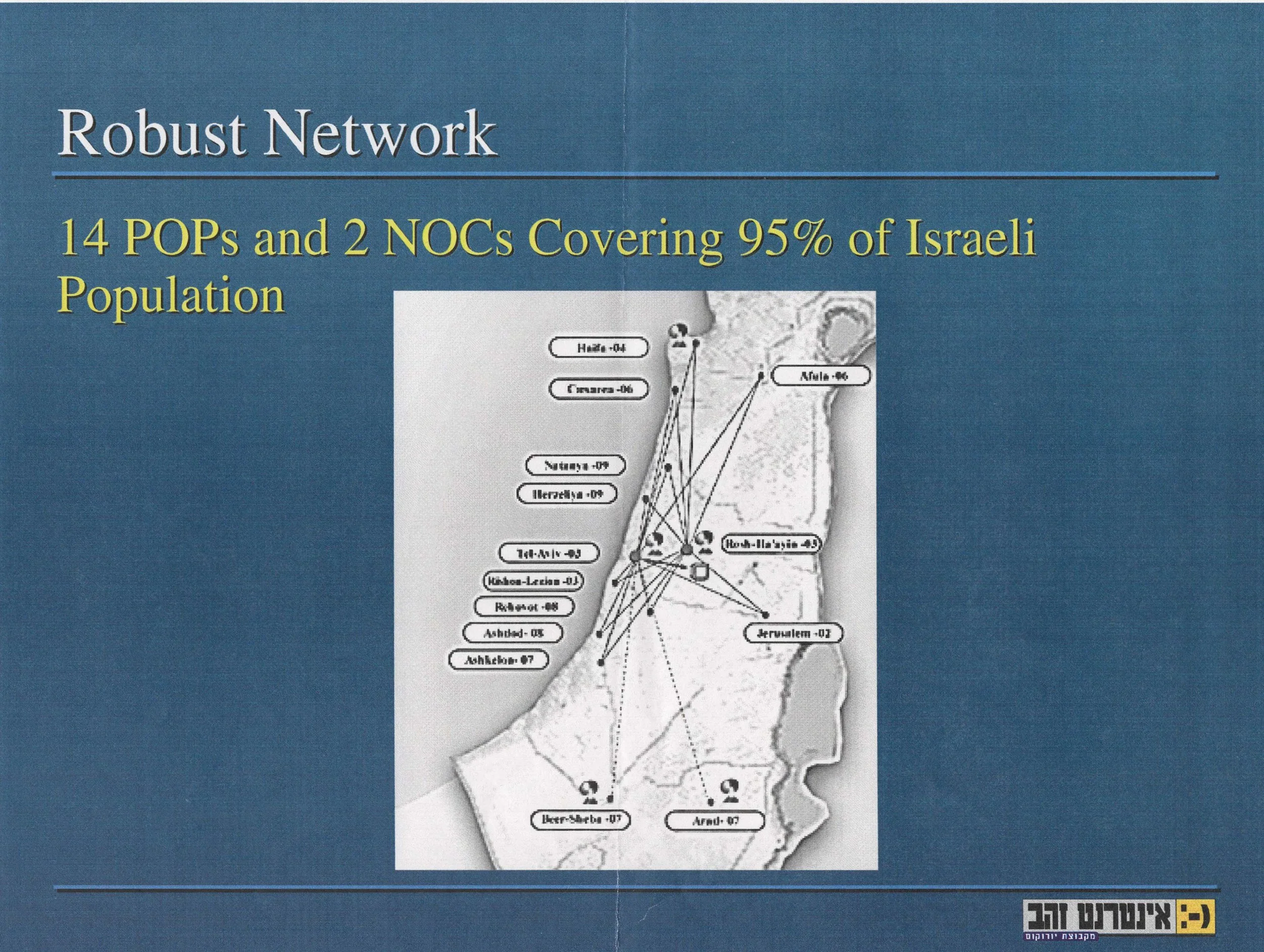
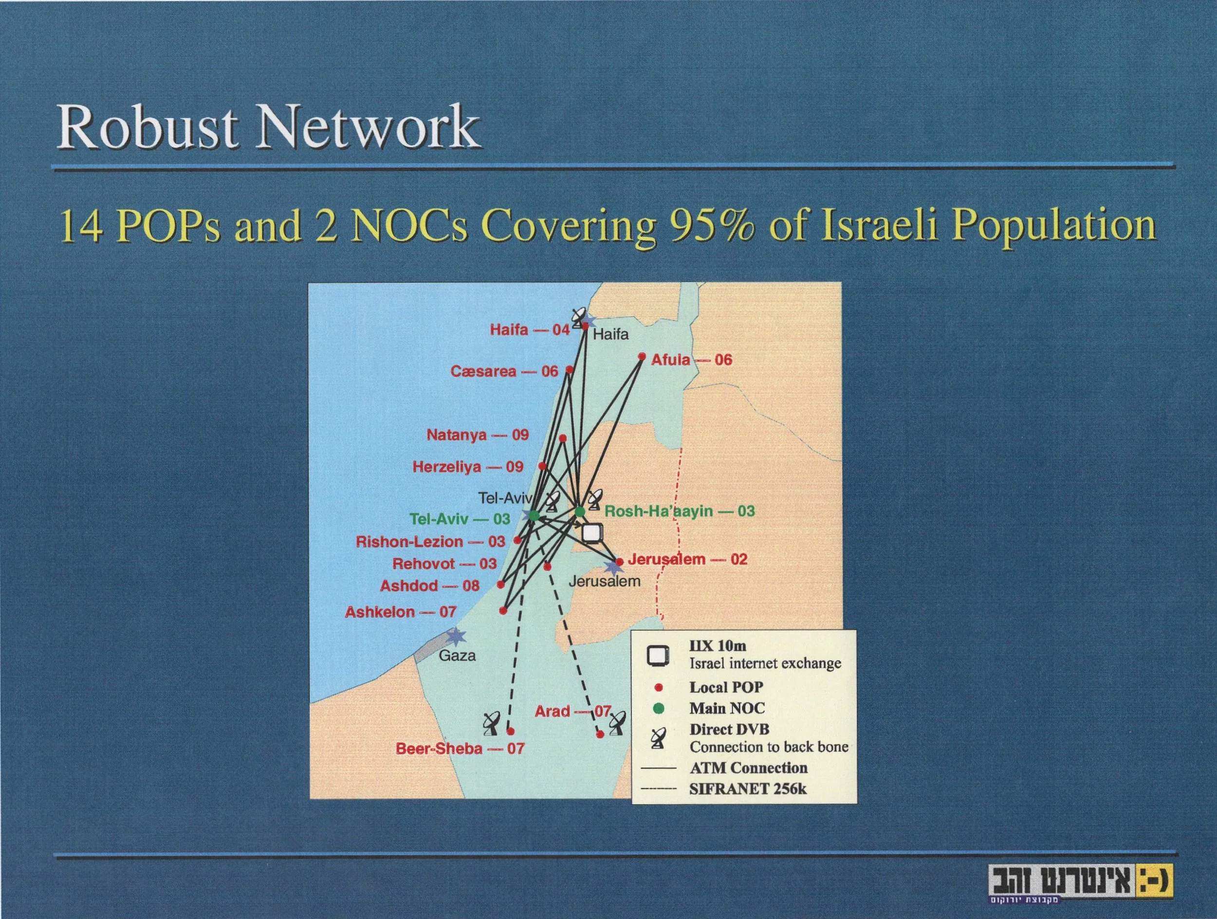
I don’t think I did the Israel map on any special software. But vector is always neater than raster, especially if it’s just a photocopy.
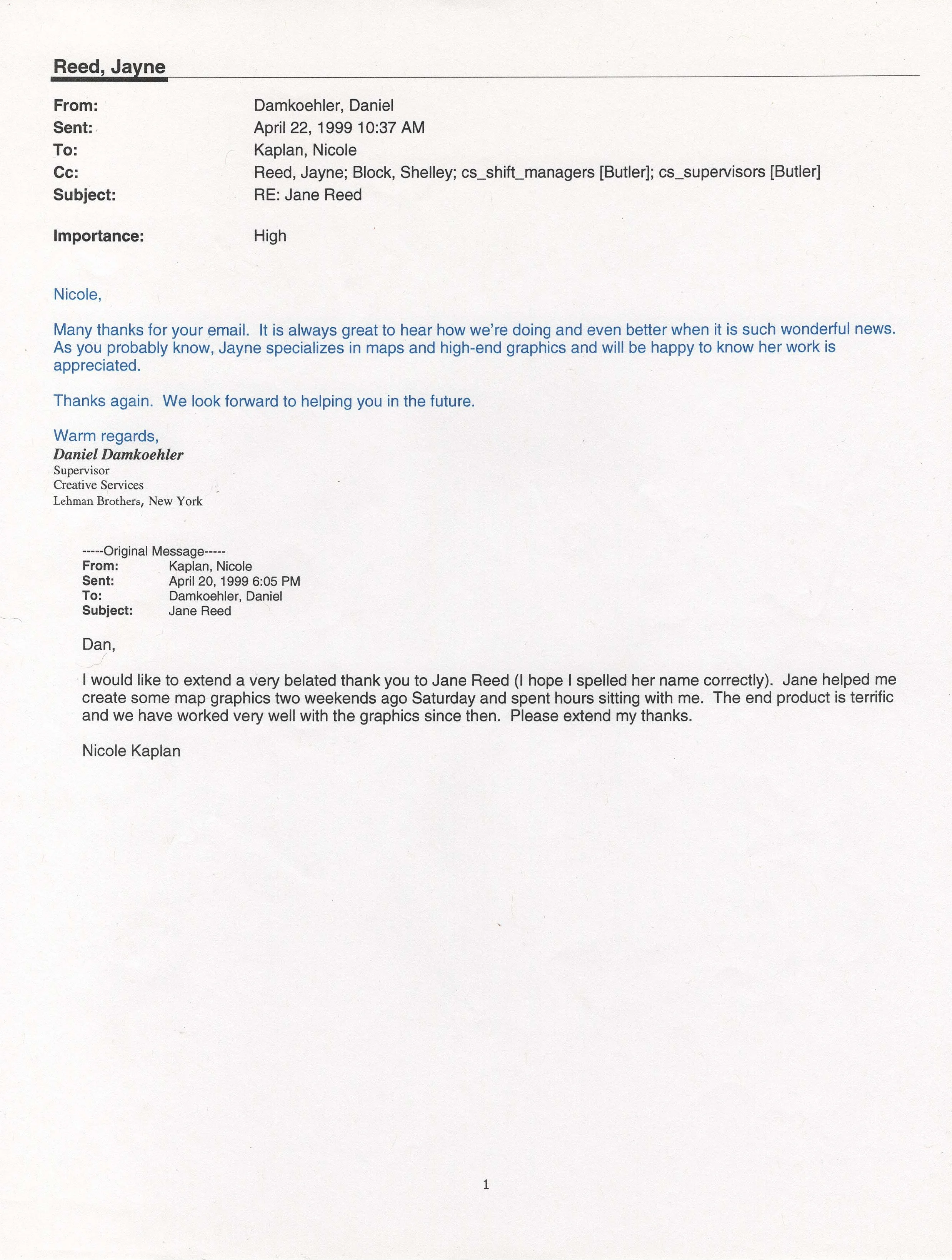
And here’s the nice letter I got from the Energy Sector —>
These maps above were made in the last century when MapInfo was Earthbound
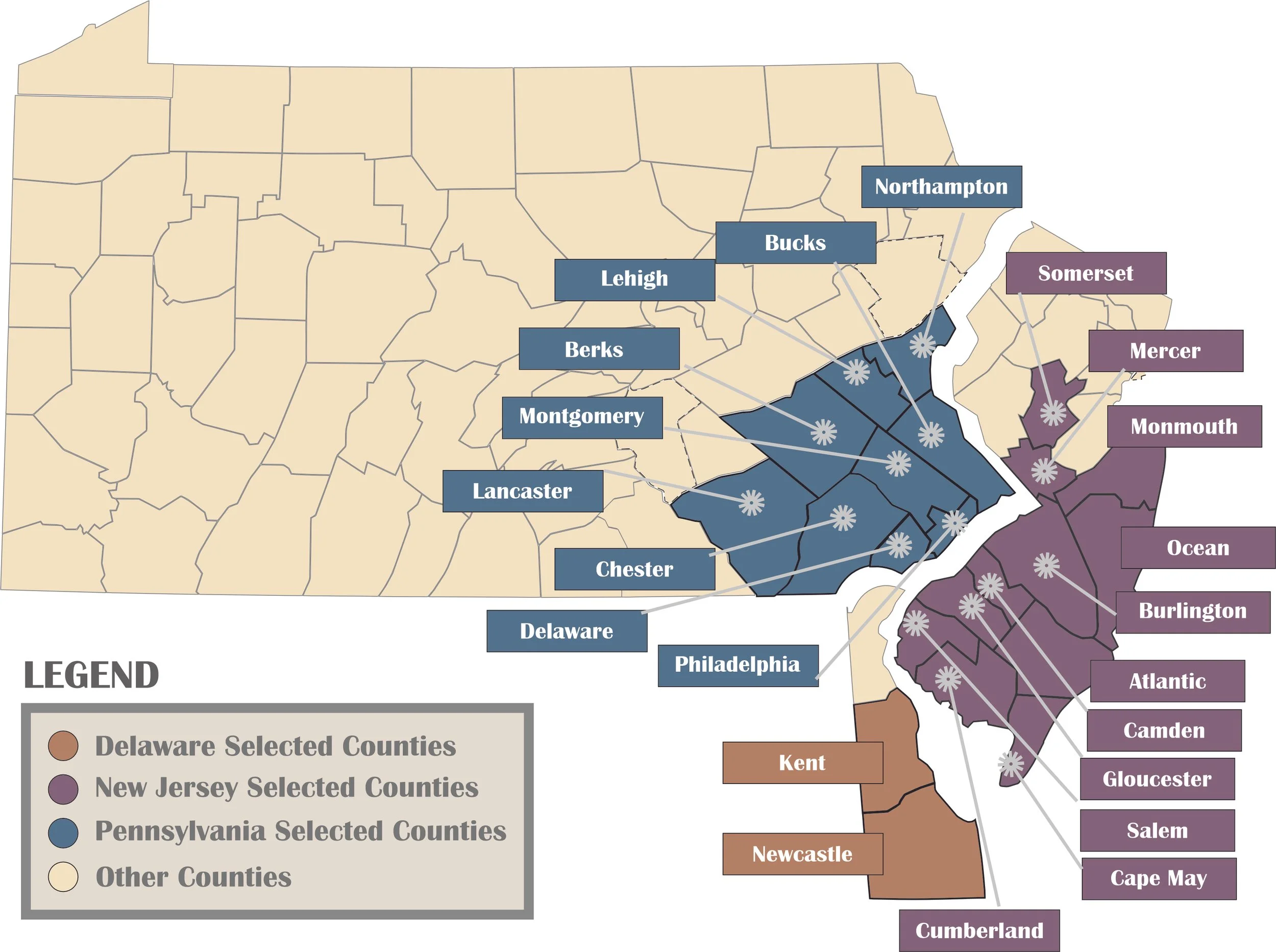
Here’s one I made fairly recently: